After our trip on the Affric Kintail trail in Scotland we were up for more hiking adventures. After a pleasant meeting with tasty food and drinks, Morocco was chosen as the new destination. Not much later it turned out that Jan could not come with us this year due to heel surgery and associated rehabilitation. Unmistakably a loss, who would take care of the crackling campfires?
The following months we planned our trip, searched on topographical maps and international passports where arranged. On Monday, April 8, we could finally leave for Marrakesh.
Inhoud
- 1 Five-day hike on the Toubkal Circuit in the High Atlas, Morocco
- 1.1 Marrakesh
- 1.2 Day I From Imlil to the village of Tacheddirt
- 1.3 Day II Van uit Tacheddirt over de Tizi n’ Likment pas naar Azib Likemt
- 1.4 To the valley of Azib Likment
- 1.5 Day III From the valley of Azib Likemt to the green oasis of Amsouzart
- 1.6 Day IV A rest day at Lac Ifni
- 1.7 Day V From lake Ifni along the Ouanoukrim pass back to Imlil
- 2 Map of the Toubkal Circuit
- 3 GPX
- 4 Practical information Toubkal Circuit
- 5 Photos Toubkal Circuit
Five-day hike on the Toubkal Circuit in the High Atlas, Morocco
Toubkal Circuit. 5 days ↔ 87,69 km ↑ 5892 m ↓ 5993 m
Marrakesh
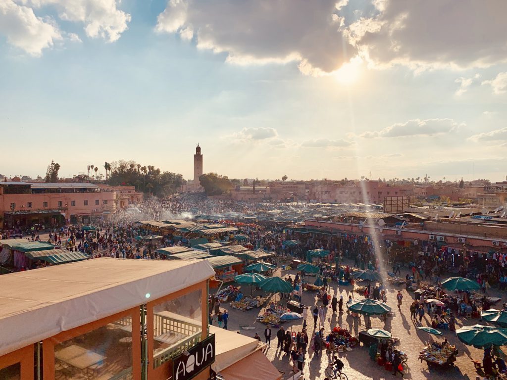
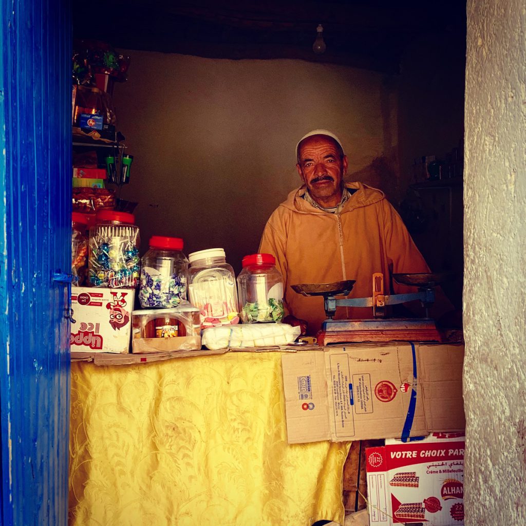
When we arrive in sparkling Marrakech, we drop off our bags at the cozy Medina Hostel and head into the souks immediately. The bustling city has a lot to offer and there is a pleasant vibe. We arrange fuel for our stove, visit the lively Jamaa el Fna square and the surrounding Medina. After another Pastis (bought at the airport) we crawl into our bed. The next day we take a Grand Taxi (600 Dh) in the direction of the mountain village of Imlil.
Day I From Imlil to the village of Tacheddirt
↔ 9.99 km ↑ 963 m ↓ 314 m
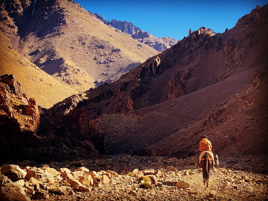
After arriving in the market town of Imlil, we rent crampons in a local shop (45 Dh for the three of us) and set off. An asphalt road winds up the mountain towards the Tizi n’Tamatert pass at an altitude of 2280. Where possible we take a shortcut between two winding hairpin bends.
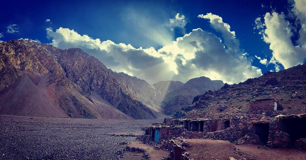
A small village immediately gives us some insight into the lives of the local mountain people and their primitive way of life. After one and a half hour of firm climbing we arrive at the windy pass. At a small booth we enjoy a fresh cola in a dusted 33 cl bottle and stare at the impressive mountains around us.
The trail now runs over a wide sandy path towards Tacheddirt on the other side of the deeply cut valley. Along the way we eat a tagine with tomato, onion and eggs. Just before a Berber village, which is dressed in shades of brown, a primitive campsite is indicated on our map. We fraternize with some young Moroccan students who offer us fragrant mint tea and lamb-minced burgers with cumin and coriander. When we pitch our tent, a rickety Mercedes bus with construction workers stops.
Animosity at the campsite
An old man with a white beard in dark grey jalaba and a bleached cap on his head approaches us and asks for money. We have not yet mastered the Moroccan way of bargaining and before we know it the whole bus stands around us and there is a lot of noise. Eventually we decide, under light pressure, to go to the nearest gîte in Tacheddirt to spend the night. The promise to be allowed to camp there is not more than a false promise, the man pushes us off the bus, takes his commission and is gone like the wind. For 200 Dh we try not to let it get to our heart. But the atmosphere is not cheerful at all.
Day II Van uit Tacheddirt over de Tizi n’ Likment pas naar Azib Likemt
↔ 13.49 km ↑ 1344 m ↓ 1235 m
The sun is still hiding behind the mountains which are shrouded in shades of brown as we leave the cold ‘gîte’. The extra kilometres to the campsite are a pleasant walk-in to the climbing work that will follow. With some fear for what’s to come we start the tough climb. The rocky path runs zigzag over the bare mountain side and after a while we catch up with two Romanians who also venture on the elongated climb. We are rising fast and the morality is good.


When we get to the snow line, the crampons have to get on. We see the heavily packed Romanians turning around, they are giving up. They will be the only tourists that we will encounter in the coming days until the foot of the Toubkal. We continue to climb to the top. Above three thousand meters we notice that we are already catching our breath.
In addition, the last hundred meters of height are particularly stylish. After four hours of climbing we arrive at the snow-covered Likment pass at an altitude of 3600 meters.
To the valley of Azib Likment
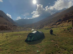
The first hundreds of meters descend the crampons remain on until the snow returns in to paths full of gravel and loose stones. A long descent of more than a thousand meters altitude brings us to the summer village of Azib Likment. During the warmer months the Berbers live here and grow millet and other crops on the many terraces.
Now the village is deserted and there is no tourists.. We have the entire valley all to ourselves, what a luxury. We put our tent down next to the flowing mountain river, cook, filter water and enjoy the evening. When the sun disappears behind the snow-covered ridges and the sky fills with hundreds of stars, we go to sleep. Tired but satisfied.
Day III From the valley of Azib Likemt to the green oasis of Amsouzart
↔ 20.27 km ↑ 833 m ↓ 1615 m
When the light comes behind the mountain range we crawl out of our warm sleeping bag. We have to wait for the first warm sun rays to let the ice of our tent and sleeping bags evaporate. Not much later, after a substantial bowl of home made granola, we can go on the road again. We will march past gurgling mountain streams in a beautiful valley in ochre tones.


The route is now going up steadily. We come across several Berbers on donkeys. They go to the Likemt valley to work on the land. After a pleasant climb we arrive at the Tizi n’Ououraine pass where we enjoy a sublime view of the Toubkal massif. Between a herd of grazing goats and a somewhat timid goat herder we rest a few hundred meters lower.
A long descent to Amsouzart
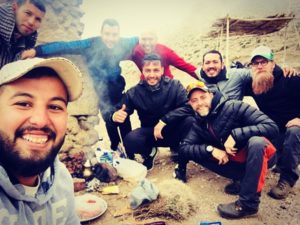
After dinner it goes further down, there seems to be no denouement in the endless descent over winding donkey paths that lead to the green valley in the distance. We are therefore happy when, after more than 1400 altimeters, we arrive in the peacefully sleeping village of Amsouzart. We still have a good time with a few construction workers who are constructing a path while we do not understand each other. The universal language of laughter in combination with a few Arabic words create some hilarity.
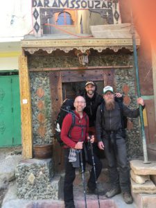
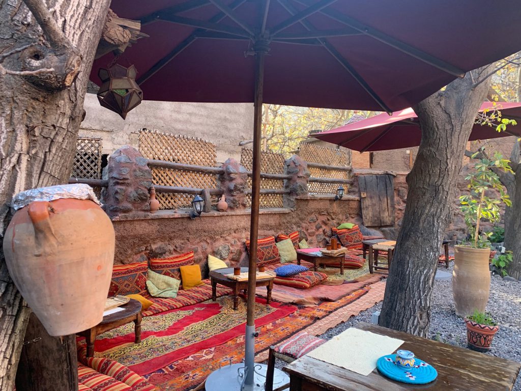
Just across the river we stop at the Riyad dar Amsouzart where we spend the night. A nicely furnished ‘gîte’ with sympathetic owner. We enjoy a delicious tagine, cold shower and a soft bed. The great WiFi brings us back to civilization and the home front is kept informed of adventures and progress.
Day IV A rest day at Lac Ifni
↔ 11,76km ↑ 1054 m ↓ 527 m
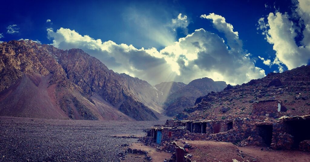
After a typical Moroccan breakfast with flat bread, olives, argan oil and sweet honey, we walk to the higher Ifni lake. Today is a day of rest, although that’s relative. More than 1000 altimeters still have to be overcome, but the broad path winds its way up gentely to the enclosed mountain lake. Along the way we come across poor Berber villages where we make time for some photos and ‘couleur locale’.


When we reach the top, the azure blue water shines deep below us. We hike around the filled crater and then arrive at a small deserted summer camp. We choose one of the many sheltered stables to spend the night. The rest of the day we’re enjoying the surroundings, laughing with silly jokes, bawdy comments and our own suffering. Ready for the next tough day, or we think so.
Day V From lake Ifni along the Ouanoukrim pass back to Imlil
↔ 32.18km ↑ 1698 m ↓ 2302 m
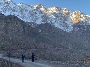
We wake up early, it appears too early. An indulgent had his alarm clock still on European hour. An hour later it is really time to get out of bed. It is six o’clock in the morning when we pack everything and prepare a large hot meal. Pasta with lentils and spicy sauce supplemented with a cinnamon roll early in the morning is a challenge. But we can use all the energy to bring the day to a good end. When the sun is rising behind the awesome mountains of Lac Ifni, we start our last hiking day.


Over a wide funnel-shaped block field we head towards the gorge that will lead us to Tizi Ouanoukrim. We rise steadily through the beautiful canyon. Regularly we rest a bit or take time for a photo opportunity. As always, the last few steps are the hardest, but after six hours of continuous climbing we finally arrive at the snowy pass. We sit down and prepare a hot meal.
Across the Tizi Ouanoukrim pass to the Refuge de Toubkal
After an hour of rest we start a long descent of more than 2300 altimeters. Soon we need the crampons to cross the snow fields. The first hundred meters are still quite harsh and we have to keep our attention. But afterwards it is pure fun in the snow. We walk towards the considerable big mountain hut of the French Alpine club. The huge hut and the run-up to the top of the Toubkal seem like an ant’s nest.
Just like Mont Blanc, the fact of being the ‘highest mountain’ attracts many tourists, while there are infinitely more beautiful places where you will not find anyone. During the rest of our five days we hardly met anyone and now we stand among a few hundred people, donkeys, garbage dumps, guides and cooks. It does not immediately make us happy.
Descend from the Toubkal Refuge to Imlil
We don’t want to walk up the Toubkal in a continuous traffic jam and so after some refreshment we continue on to Imlil. The descent is difficult due to the many oncoming traffic and heavily loaded mules with packed bags. The long day is also starting to take its toll and fatigue is starting. We are therefore happy when we arrive in lovely Imlil where we can enjoy a hot shower, delicious food and afterwards a warm bed in the cozy Maison Aït Maisan.
We sleep around the clock and after a traditional morning meal we take a bus back to Marrakesh. A fantastic trip with highlights that cannot be counted on two hands. In terms of difficulty level, I may have pushed my companions to the limit on the Toubkal Circuit, but all three of us have successfully completed the journey.
We spend the last day in bustling Marrakesh where we buy souvenirs for the home front, explore the turbulent souks and the tanneries smelling of pigeon faeces. We also enjoy the local delicacies and celebrate my 43rd birthday with fresh beer (hard to find and expensive) and enchanting belly dancers. When evening falls we walk the busy Jamaa el Fna with its whistling snake charmers, scented food stalls and mesmerizing music bands to take a taxi to an apartment near the airport.
Map of the Toubkal Circuit
GPX
Practical information Toubkal Circuit
Money
In Morocco you pay with Dirham. 100 Dh is approximately equal to 10 €.
Transport
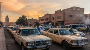
Marrakesh is a popular tourist destination and therefore there are enough flights. It may be wise to look just outside the borders at airports. We flew from Cologne with Ryanair (I don’t really recommend this myself). The Marrakesh airport is as good as against the city. Barely seven kilometres separate the runway with the famous Djemaa el Fna square in the centre of the city. There are shuttle buses but a taxi may be faster and cheaper.

When we arrived we paid 200 Dh (while they asked 300), in the return we paid 100 Dh. Perhaps it is better to walk down the parking lot to the main road and hold a taxi or motor taxi there. We did it with the mototaxi for 20 Dh, but without luggage back then. In Marrakesh we slept in the Medina hostel, a small hostel with friendly staff, hot shower and good wifi. we paid around 350 Dh for three, that’s 35 euros or 12 euros per person.
Most flights leave very early in Marrakesh, Flashback House is a good option to spend the last night. Located less than a kilometre from the airport. Apartment with every comfort. Zoom out on the map above for the exact location. For transportation between Imlil and Marrakesh, it is best to arrange a shuttle service or share a taxi. Behind the Djemaa el Fna square there is a stand with ‘Grand Taxis’. Zoom out on the map for the exact location.
Signage Toubkal Circuit
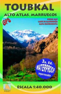
The Toubkal Circuit is not signposted and the topographic maps of the region are not ideal. With a good GPX track and some navigation skills, the trip is easy to do. We used the Spanish card Alto Atlas Marruecos 1: 40000 from Piolet.
Many hikers choose to make the tour with guide, cook and pack animals. Undoubtedly also a great experience to discover the ‘couleur locale’ up close.
For those who are interested there are numerous tourist agencies that offer packages. Negotiating, without losing sight of the local economy, is of course recommended.
“Imlil mountain guide office” is an association that was founded in the late 1980s by mainly French mountain guides. This was the first guide association in Morocco was born. All the guides are qualified and well-trained.
For more information:
Tel: 00212 (0) 524 48 56 26,
E.mail: bureau.guides@yahoo.fr
Imlil, Asni 42150, BP 22, Marrakech, Morocco.
Tours without a guide and donkey drivers are apparently not very common. But it’s possible as you can see.
Provisioning & accommodation at the Toubkal Circuit
There are several villages along the way. There are plenty of shops in Imlil and there are also some outdoor shops where you can rent equipment. Expect second-hand equipment. In Tacheddirt, Amsouzart and neighbouring villages you can buy limited items.
Not all villages on the map are effectively inhabited in the spring, winter and autumn. They are often summer villages where Berbers work their land in the summer and tend their cattle. In certain periods there is nothing to get. For water we had a filter system from CarePlus. For the rest, we were provided with food for the entire trip, although we did eat along the way. In Marrakesh, there are plenty of accommodation options
Note: Dress modestly during your stay in the Atlas mountains. Respect the local culture and inhabitants.
Weather
Morocco is sometimes called the coldest warm country in Africa. It can be quite cold in the mountains. The real hiking season only starts in May when most of the snow has melted and the passes are free, but this also brings the crowds. We chose to go a little earlier in the season and almost no-one came across the trail outside the local mountain dwellers and herdsmen.
TOUBKAL CIRCUIT WEATHERMake sure you are well aware of the conditions in the mountains and on passes and do not take any unnecessary risks! See that you have a back-up plan, The Atlas Mountains or the Anti-Atlas are large enough to make beautiful walks should the circumstances not allow you to undertake this journey. The Cicerone guide has numerous alternatives and useful information about the High Atlas.
Pay attention! These are the weather forecast for Imlil at 1750 meters. The weather and the circumstances can differ remarkably on the passes and higher parts. Always be prepared in the mountains for all climatic conditions!
Toubkal Circuit Books & Maps
Security
In the fall of 2018, two Scandinavian girls were brutally murdered by IS supporters at the foot of the Toubkal. It appears that this was an isolated incident.
In my opinion, Morocco is no less safe than, say, Utrecht, Paris or Brussels. There are some scammers walking around in Marrakesh. If you have questions you better ask older residents and don’t be intimidated by ‘handy boys’ who ask for money for just about everything. In the mountain villages the people are generally very friendly and helpful. The Moroccan way of haggling is something you quickly acquire.
Links
- Follow us on Facebook, Instagram or Twitter
- Guides Imlil
- Hotels Marrakech
↧ Comment section Toubkal Circuit↧
Photos Toubkal Circuit


