


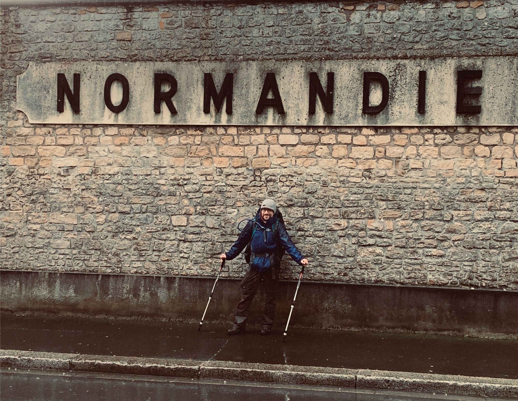
During my school days I visited Normandy and since that time I always wanted to go back. Seventy-five years after D-Day seemed the ideal time to return to the historic beaches in the north-west of France. We selected the part of the GR 223, also known as the ‘Sentier des Douaniers’, that runs along the front line where once thousands of brave men landed to liberate the European continent.
Thursday morning we left early in the morning to arrive in the desolate Quinéville, located in the ‘Parc Naturel Régional des Marais du Cotentin et du Bessin‘.
Inhoud
Hiking along the D-Day invasion beaches on the GR 223 ‘Sentier des Douaniers’

GR 223 ↔ 112.50 km ↑ 1809 m ↓ 2022 m GPX
Day I Quinéville – Sainte-Mère-Église
↔ 20.81 km ↑ 377 m ↓ 490 m
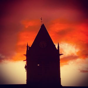
We depart from the ash gray church of Quinéville and immediately get acquainted with the typical Norman landscape. The ‘Sentier des Douaniers’ winds through the green landscape between the characteristic hedges and meadows. We have to speed up because the day is already half past and we have set a clear goal. At eleven o’clock Monday morning we want to be in the American cemetery on Omaha beach, about 115 kilometers further on the winding GR 223.
The narrow roads and paths are wet, to the extent that it is sometimes difficult to talk about country roads. Sometimes they are just flowing rivers in the landscape. So regularly some creativity is needed to continue our way. Or through the flowing water or through the mown fields where we sink into the heavy clay soil. Sometimes we come across small memorial monuments of the Second World War. Towards dusk we arrive in Sainte-Mère-Église. The fishing village was liberated on June 6, 1944 by the 82nd airborne divisions of the US Army. A dummy hangs on the church in memory of parachutist John Steele, who stuck to the tower with his parachute. When he was attacked by the Germans, the soldier survived by keeping himself dead.
It is getting dark so unfortunately we cannot stay long in the village, we march further and set up our tarp a few kilometres further in a marshy meadow.
Song: The Shores of Normandy by Jim Radford, war veteran and once the youngest person who witnessed the Battle of Normandy as a soldier on 6 June 1944.
Day II Sainte-Mère-Église - Le Grand Vey
↔ 25.47 km ↑ 482 m ↓ 519 m

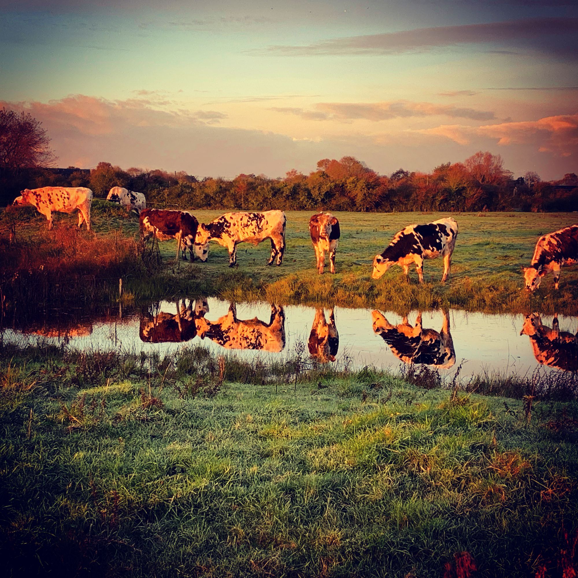
At the crack of the day we wake up with the birds chirping cheerfully. Everything is frozen but the rising sun announces a beautiful day. We eat some muesli and pack our backpacks. By nine we are back on the road. We have clearly crossed the waterline of the swampy region and this side is less wet. We continue walking along the GR 322, country roads alternate with small paths and quiet concrete tracks. There is hardly any traffic, so the paved roads that we encounter are not necessarily unpleasant.
When we have lost sight of the road for a moment, we decide to cut off a piece through the swampy meadows. A frisky deer shows us the passages through the dense hedges and soon we are back 'en route'. Through the moist fields we walk towards the Normandy coast. We arrive at a stone monument for General Leclerc, a pseudonym to protect his family. After having fought many battles in Africa, the chief officer landed here with his Second Armed Division and freed occupied Paris.
Utah Beach
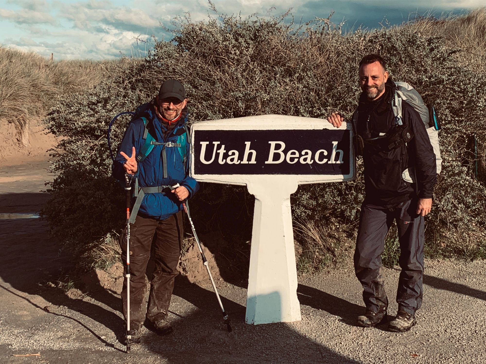
We stroll along the windy beach and take a look at the oyster beds and some bunkers that are silent witnesses of the past. In the pouring rain we arrive at Utah Beach, the westernmost of the landing beaches on D-Day. The American 4th Infantry Division came ashore under the command of Brigadier General Theodore Roosevelt Jr., son of former President Theodore "Teddy" Roosevelt. There is a modern museum and also a cozy and especially warm brasserie in the 40s style. We hurry in quickly and enjoy some foaming Pelforth's and tenderly braised turkey with camenbert sauce.
After the hearty meal we continue our journey and after another ten kilometres we set up our tarp in the marshy 'Parc Naturel Régional des Marais du Cotentin et du Bessin' On a slightly higher stretch we lie dry and fall asleep with the sound of thousands of ducks and other water birds.
Day III Le Grand Vey - Isigny-sur-Mer
↔ 27.57 km ↑ 207 m ↓ 271 m
On day three we have to cross the 'Canal de Carentan' and the river 'Vivre', which forms the border between the Manche and Calvados. This also means quite a few paved roads today. Via a long winding concrete lane we arrive at the river Douve. We cross the stream over the lock at 'Hell's Corner'. The flood defence was a strategic point and was fought by the '501st Parachute Infantry Regiment'.
We walk further along the canal to the sleepy town of Carentan, which was fiercely fought in 1944. The Germans in particular suffered heavy losses. 'Carentan' is, among other things, a theme in an episode of the war epic 'Band of Brothers' produced by Spielberg and Hanks.
We eat a delicious 'plat du jour' with a 'pichet' of wine next to the now peaceful village harbour before moving on.
Hiking in the rain along the canal
In the pouring rain we saunter along the fast-flowing canal and later through muddy roads and wet concrete tracks towards Isigny-sur-Mer. A few kilometres before the butter village we hide in a 'Bar Tabac' that also serves as a store and improvised post office. The fuzzy owner thinks we are Germans and doesn't understand him ... In French, he gossips about us with his grandmother. That we think we are God and that the GSM signal would work for us while they are unsuccessful, that we are dirty and wet, etc. If we switch half an hour and two foaming beers later to fluent French, the host doesn't know how to act. Suddenly he is the 'kindness' himself. We get a corkscrew from him to open our bottle of wine that we bought and he says goodbye to us.
Fortunately the internet did not work or my brother had already booked a hotel, instead we retreat into the chattering rain and look for the best possible place to sleep. We spend the night on a dry stretch of path and with too much traffic noise in the background. The bottle of cheap red wine brought comfort.
Day IV Isigny-sur-Mer - Point Du Hoc
↔ 24.85 km ↑ 445 m ↓ 433 m
When we break up,it's raining heavenly. We eat fresh baguette, cheese and fragrant salami under a portal in the centre of the church village and drink hot coffee in the local brasserie. When we leave, it clears up. We walk out of the village, known for its sweet caramels and farm butter, and after a few kilometres we decide to take the variant of the GR 223 route. The map comes in handy here because the variant is hardly indicated.
Around noon we arrive in the coastal village of Grandcamp-Maisy. It has a desolate look and it is hard to find a decent place to eat. Eventually we find a nice bistro on the deserted dike. We eat generously and buy a bottle of cider for later in the evening.
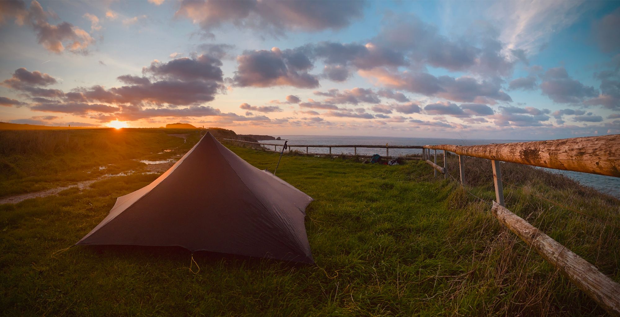
Sunset on the Normandy cliffs
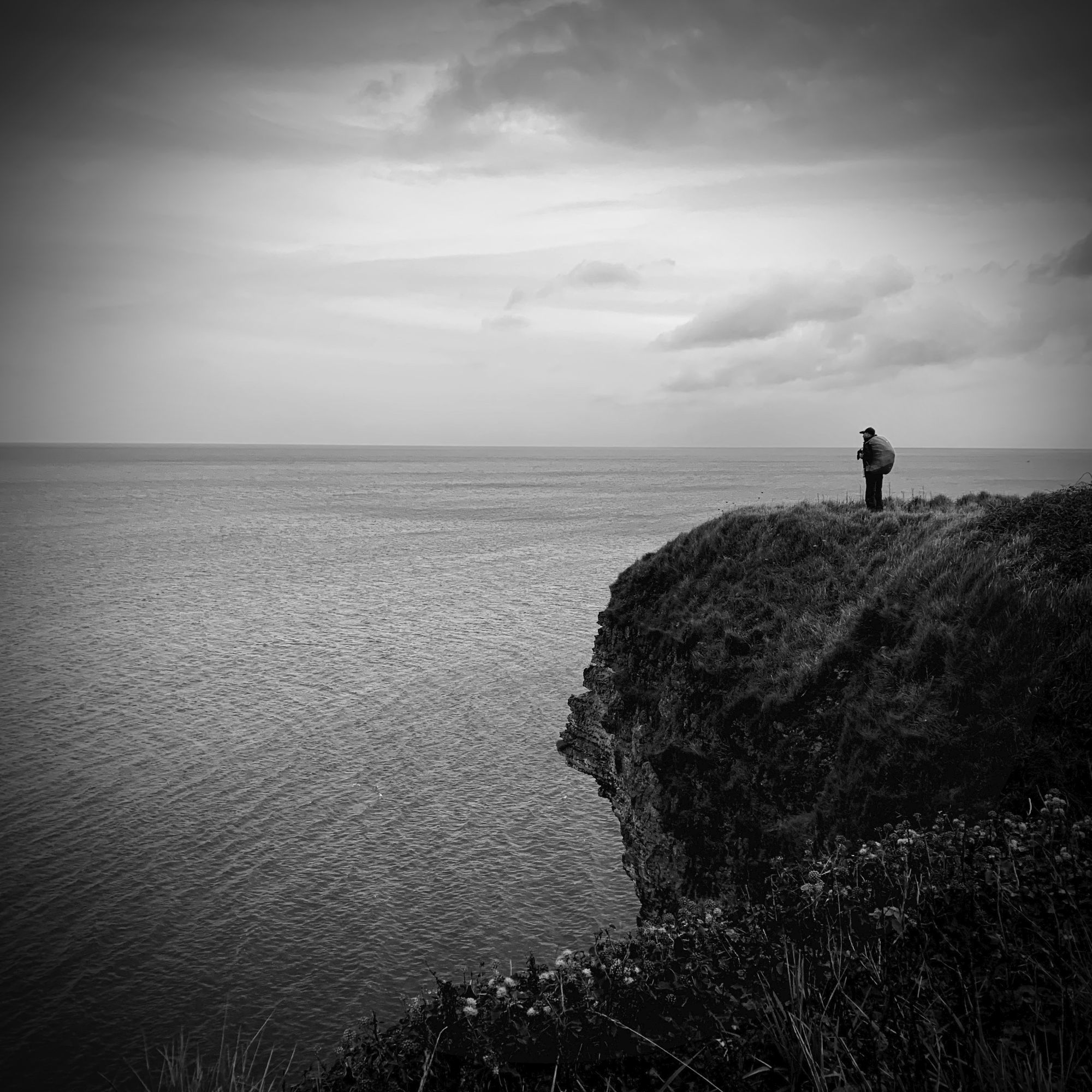
After the copious meal we walk a bit on the beach until we can go no further and climb the steep cliffs. After a few kilometres we see Pointe du Hoc in the distance and the winding mass of tourists on the headland. We have now left the GR 223 path but chose to walk over the steep rocks. Through the fields we arrive at the historic point.
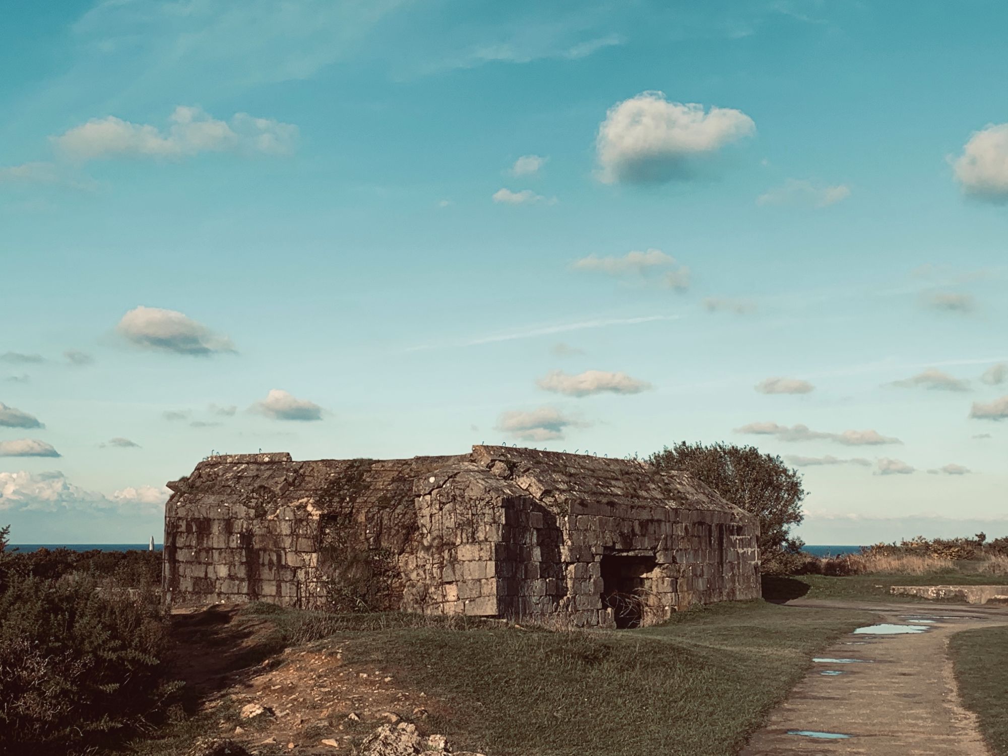
In World War II, this point was covered by German bunkers and cannons as part of the Atlantic Wall. The Germans had installed six 155 mm guns to defend the landing beaches. On June 6, 1944, during landing in Normandy, Pointe du Hoc was a target of the Allies to protect the beaches from the threatening guns of the 155 mm ship cannons. This difficult and arduous mission was entrusted to the US 2nd Ranger battalion. 225 men were supposed to land on the beach to destroy the cannons, only 90 Rangers survived.
The massive bunkers, the majestic view and the many bomb craters are impressive. However, it is a bit too busy for us so soon we walk further over the cliffs. A few kilometres away we set up our tarp with a beautiful view of Pointe du Hoc and the setting sun. At a cup of bittersweet apple cider we think over what happened here 75 years ago. When the sun is down we crawl under the down for the last time.
Day IV Point Du Hoc - American Cemetrery Omaha Beach
↔ 13.79 km ↑ 298 m ↓ 309 m
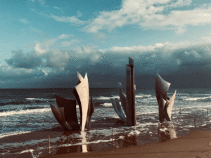
We get up early and head back on the road. We arrive at Omaha Beach through the fields above the rocks. On out way we take more pictures of relics from the war and along the coast we continue along the deserted beaches where so many brave soldiers once lost their lives. The weather is inclement and the cold rain is falling on us. We pass another monument in the sea before we arrive at the foot of the American Cemetery. We see a veteran with his entire American family, he must be one of the last living witnesses of D-Day.
Visit at the impressive American Cemetery
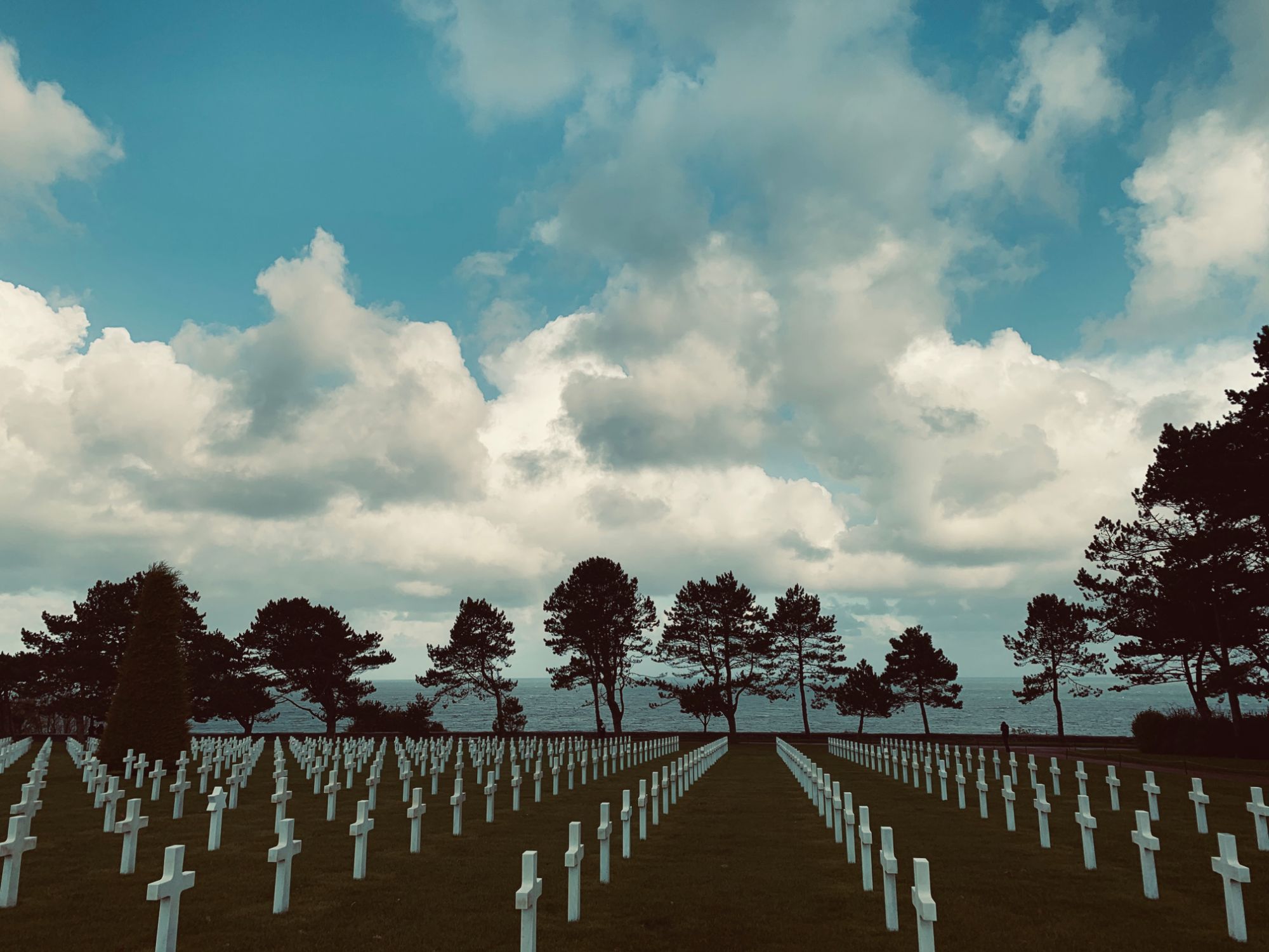
We visit the impressive cemetery with more than 9000 white marble crosses. The 11 November ceasefire ceremony is somewhat disappointing with recorded gunshots and a boring speech by some French authority. But Remembrance Day is also a reminder of that other terrible war. After the visit we return home to the family grateful for the sacrifices that many have made so far from their own families to liberate Europe.
Map GR 223
GPX
GR 223 Practical
Transport
We drove by car to France and got a pick up 5 days later, easy. The nearest station at Quineville is Valognes, from there you have to take a taxi. Omaha Beach can be reached by bus to Caen station.
Signposting GR 223 'Sentiers des Douaniers'
The GR 223 is also called the 'Sentier des douaniers'.
The signage on the GR 223was generally good. Sometimes we took an alternative trail that was indicated on the map, but in practice it was much less signposted than the main road. At other times we chose to walk our own trail because we thought it would be better or because we wanted to walk along the coast, for example.
The route is well marked, but a map is certainly handy. We used IGN cards 1311OT Valoges - Ste-Mère-Eglise Utah Beach and 1412OT Pointe Du Hoc - Omaha Beach.
You can walk the GR 223 path even further along the landing beaches of Gold, Juno and Sword Beach and the artificial harbour of Arromanches. It is also possible to continue walking in the other direction towards Mont-Saint-Michel and Bretangne.
Provisioning & accommodation at the GR 223
We spend the night under our tarp in the wild, which in principle is no problem. There are also numerous hotels and B & Bs in Normandy that receive more than five million tourists annually. You can stock up on this trip in Sainte-mère-église, Carentan, Isigny-sur-mer and Grandcamp-Maisy.
Books and Maps
Links
- Follow us on Facebook, Instagram of Twitter
- GPX GR 223
- Hotels and B&B's Normandy
Disclaimer: English is not my native language, all corrections are welcomed
Photo's GR 223


Geef een reactie