


Hiking Gran Canaria – “Ceci n’est pas un avion.”, the colourful Airbus A320 from Brussels Airlines, a tribute to René Magritte, takes us in four flight hours from our capital Brussels to the Canary Island off the coast of the Western Sahara. Crossroad on the shipping routes between America, Africa and Europe, history has left impressive marks on the island. Previously I walked on the GR 131 Tenerife.
Inhoud
- 1 GR 131 hiking Gran Canaria
- 2 Day I Puerto de las Nieves
- 3 Day II Puerto de las Nieves – Artenara
- 4 Day III Artenera – San Bartolomé de Tirajana
- 5 Day IV San Bartolomé de Tirajana – Barranco de los Vincentes
- 6 Day V Barranco de los Vincentes – Maspalomas
- 7 Map
- 8 GPX
- 9 Practical information Hiking Gran Canaria
- 10 Photos Gran Canaria
- 11 Related content
- 12 Comments
GR 131 hiking Gran Canaria
![]() GR 131 Gran Canaria ↔ 88.70 km ↑ 3718 m ↓ 3746 m
GR 131 Gran Canaria ↔ 88.70 km ↑ 3718 m ↓ 3746 m
Day I Puerto de las Nieves
![]() GR 131 Gran Canaria ↔ 4.72 km ↑ 478 m ↓ 28 m
GR 131 Gran Canaria ↔ 4.72 km ↑ 478 m ↓ 28 m
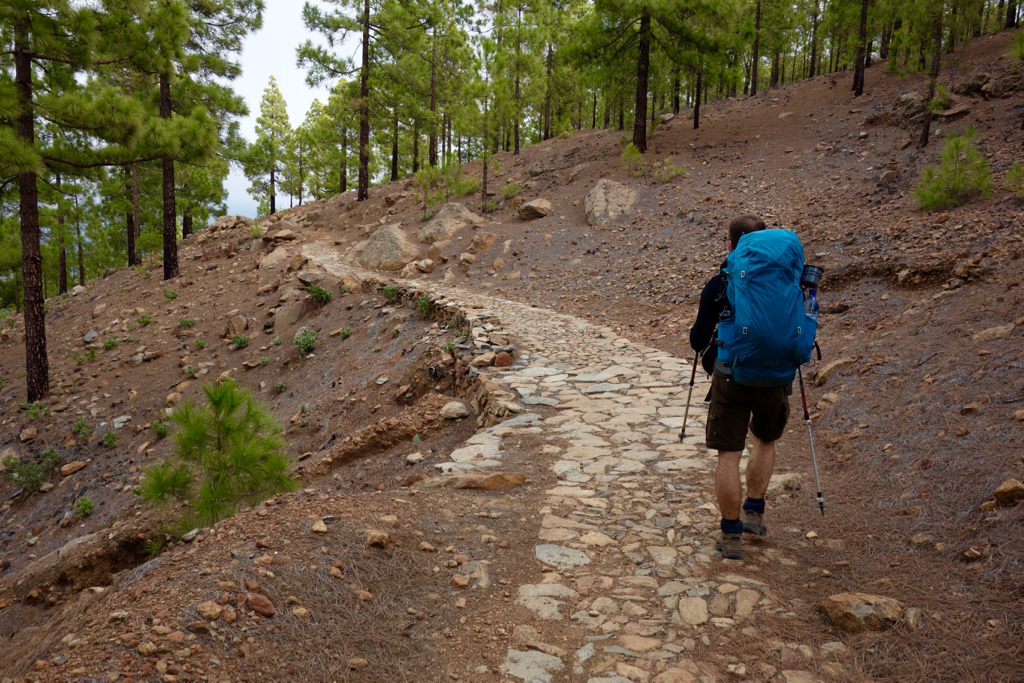
At the pleasantly busy airport we take the express bus to the capital Las Palmas de Gran Canaria in the north-east of the island. In the catacombs of the underground bus terminal San Telmo we have to wait for a connecting bus to take us to the white coastal village of Puerto de las Nieves.
Puerto de las Nieves
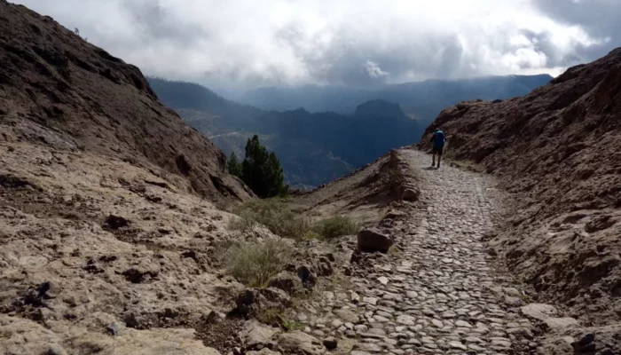
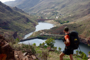
By the time we finally arrive it is already five o’clock and the setting sun announces the night. Quickly we buy ten litres of water and start our hike towards Maspalomas in the south of the island. It is immediately steep and we do not have much time. When we see on the plasticized map that there is a long, steep stretch and the sun continues to sink into the sea, we decide to put our tarp on the windy ridge.
My brother, a walking pantry, gets a plastic bottle filled with pastis out of his bag and we enjoy with it with some freeze-dried food. The sunset submerges the landscape in beautiful pastel colours. When the sun is gone, it starts to rain quickly and we crawl into our sleeping bag. The night is stormy and while thick raindrops make a nice sound-play on the sail of the trailstar, the strong sea wind hits the tightly edged flanks of the tarp all night long.
Song video: The trip – Still Corners
Day II Puerto de las Nieves – Artenara
![]() GR 131 Gran Canaria ↔ 19.17 km ↑ 1478m ↓ 580 m
GR 131 Gran Canaria ↔ 19.17 km ↑ 1478m ↓ 580 m
We wake up early, a faint morning sun squeaks through the gray clouds. We eat home-made granola and start our hike. The walking day starts with a sturdy clambering party and the colourless fishermen’s houses of Puertos de las Nieves are getting smaller and smaller among us. We’re sweating on the flanks of the steep ‘barrancos’. When we reach the flank in a small grove, we rest on a fragrant eucalyptus tree and eat some nuts and chocolate.
Eventually we arrive at a wide gravel road that leads us to the pick-nick place of Tamadaba. This would be a very nice campsite with running water, but for us it’s to early to set up camp. We walk through small mushroom-covered indigenous Canarian pine forests.
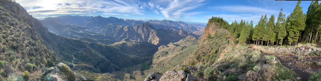
On the mountaintop, with a nice view of the staggering steep cliffs, the almost inaccessible coast and the rich biodiversity of the ravines, we enjoy the view. As we approach the village of Artenera the landscape becomes rougher.
A deep valley with freakish rock formations is visible in the depth. In the small village we drink a few chilled ‘cervezas’ and we buy spicy sausage, bread, hard cheese and water. A few kilometres outside the provincial town we find a beautiful green grassy area between the leafy woods to camp. At a crackling campfire we enjoy the evening with a glass of pastis and the bought treats.
Day III Artenera – San Bartolomé de Tirajana
![]() GR 131 Gran Canaria ↔ 21.87 km ↑ 910 m ↓ 1333 m
GR 131 Gran Canaria ↔ 21.87 km ↑ 910 m ↓ 1333 m
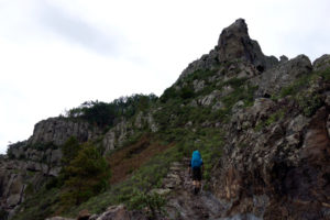
After our morning routine we continue towards Cruz del Tejeda. Along the flanks of the beautiful canyon that bathes in full sun, we have an extraordinary view of the landscape. The area has been recognized by UNESCO since 2005 as ‘World Biosphere Reserve’, and you have a beautiful view of rock formations such as the Roque Nublo and Roque Bentayga. We pass seven caves above the Tejeda ravine. Some were cliff dwellings in bygone times and one cave served as a ceremonial room with drawings and symbols of fertility on the rock walls.
While enjoying the panorama, after a short descent we arrive in Cruz de Tejeda. Here tourists stop with packed buses, taxis and rental cars to view the wide ravine. They do not see anything because a thick fog quickly came rolling out of the valley and absorbed the landscape completely in the dense mist.
We eat a sandwich with warm tortilla and drink a cold beer before continuing to climb. It continues through a forest with clear traces of a recent fire. We arrive at a narrow cart track where two dogs, barking on iron chains, uncover their teeth and make a hellish noise. Here we face a dilemma. We prefer not to pass the animals, but we do not feel like strolling through the motorway for a few kilometres.
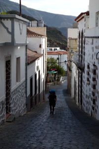
San Bartolomé de Tirajana
We risk it anyway, we hit the wall as much as possible while the wildly barking bastards make an attack on our shiny calves. Their chain is luckily not long enough and the crazy beasts go raging while we are at 50 cm distance. Between wall and animal we get along while shitting our pants. Once we are past, we are swearing and with a pounding heart we quickly get off.
The path on the flanks is in decline and we suspect that the owner of the chattering four-legged friends may have put them there deliberately to scare hikers. Many people do not seem to have passed by here in any case. We keep climbing and are almost at the highest point of our trip. After another beautiful stretch of varied natural beauty we descend towards San Bartelomé on a beautifully laid out path. Zigzagging it goes down, a test for the knees this time, the calves get some rest. Just before the town we find a beautiful camp site where we enjoy under the light of the crescent moon and the crackling of a small campfire in the semi-darkness of the evening.
Day IV San Bartolomé de Tirajana – Barranco de los Vincentes
![]() GR 131 Gran Canaria ↔ 29.41 km ↑ 779 m ↓ 1456 m GPX
GR 131 Gran Canaria ↔ 29.41 km ↑ 779 m ↓ 1456 m GPX
We are quickly back on the GR 131 and walk to the pretty village of San Bartelomé to buy drinking water. After that, it will immediately go up again before descending via the flanks of the next valley to Ayagaures. We arrive at a green oasis filled with tall palm trees and fragrant flowers.
We walk a little further and enjoy a delicious meal with salads, fresh fish, grilled meat and salty potatoes with typical Canarian salsa. A few beers later we’re loomed down by the sun and filled stomach in our chair. But we have to go further …
We briefly discuss how much water we have to buy and decide that three litres of mineral water and a bottle of Rioja will help us until the next day. We walk back to get on to the GR 131 trail again, cross the brick dam and climb further to the next valley via a wide sandy road.
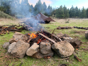
Bushcrafting
The winding road now passes through impressive rock formations and oases with scented mandarins, limes, mangoes and palm trees and winds through the landscape. Long straight stretches of dusty dirt road alternate with sharp hairpin bends that give a different view each time. Somewhere we make a mistake and turn into an unused road, at least that is what notice after a few kilometres.
In bush crafting style we are looking for a way to the valley between thorny cactusses and giant agaves. We pass a surreal looking farm full of rubbish, cackling chickens and barking dogs in too small cages. If we walk a bit further, we find a flat piece of land to set up the tarp. After almost 30 km the legs are tired and after a meal and a cup of red wine we fall asleep quickly.cactusesIn bush crafting style we are looking for a way to the valley between thorny cacti and giant agaves.
Day V Barranco de los Vincentes – Maspalomas
![]() GR 131 Gran Canaria ↔ 13.53 km ↑ 73 m ↓ 349 m
GR 131 Gran Canaria ↔ 13.53 km ↑ 73 m ↓ 349 m
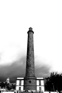
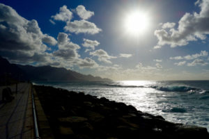
We are on the road again early and silently we leave the mist-shrouded mountains. After eight kilometres we march into the coastal town of Maspalomas. A long straight stretch next to a dry river bed brings us through the protected dunes with Sahara sand to the stately lighthouse of Maspalomas. Mission accomplished!
The town must once have been a fishing village but is now a chain of megalomaniac hotel chains, shops with luxury products, bars and restaurants. A cheerful mix of roaming retirees, parents with children who are not yet school-going and a lively gay scene make it fun to enjoy and watch with a chilled beer.
However, this does not have to last longer than one day, not our idea of vacation. After a delicious pizza made by a Neapolitan family, crazy about Dries Mertens, we go to the comfortable house that we rented from Raul. Fresh shower, soft bed at a reasonable price. The next morning with a taxi towards the airport. Again a beautiful hiking trip to a successful conclusion.
Note: English is not my native language, so there may be grammatical errors in this report. Did you see a mistake? info@caersbart.be
Map
GPX
Practical information Hiking Gran Canaria
Transport for hiking in Gran Canaria
There is one airport on Gran Canaria in the East of the island. From here you can take the bus to the north or the south. To get to Puerto de las Nieves you have to change at the ‘San Telmo’ bus station in Las Palmas de Gran Canaria. There are also many taxis on the Canary Island.

From Tenerife you can take the ferry to Puerto de las Nieves and leave immediately on the GR 131.
Signposting
The island is intersected by a dense network of hiking trails ranging from easy to walk forest trails and traditional ancient hiking trails to narrow paths that are more suitable for experienced hikers. Strangely enough, Gran Canaria is the only island in the Canary Islands where the GR 131 is not signposted. GPX tracks from each individual stage can be found in the daily reports above.
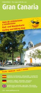
Hiking maps are hardly there, we did it with a German hiking & mountain bike map at 1:50,000.
Supplies
Puerto de las Nieves ![]()
![]()
![]()
![]()
Tamadaba ![]() * There was running tap water when we passed it.
* There was running tap water when we passed it.
Artenara ![]()
![]()
![]()
![]()
San Bartolomé de Tirajana ![]()
![]()
![]()
![]()
Ayagaures ![]()
![]()
![]()
Maspalomas ![]()
![]()
![]()
![]()
Weather on Gran Canaria
The climate of Gran Canaria is soft all year round and depending on the location or altitude, there are several microclimates. They divide the island into three different climate zones: in the north-east it is humid, in the south-east it is dry and above 1500 meters altitude, the area known as ‘Cumbres’ (the tops) has a mountain climate.
GRAN CANARIA WEATHER THIS WEEKThis diversity also provides for the changing landscape of Gran Canaria and the nickname of the island ‘continent in miniature’. It is important to recognize these differences in the climate and landscape of Gran Canaria in order to make a good choice for the route, footwear and clothing for a walking tour.
Books & maps about hiking in Gran Canaria
Hiking Gran Canaria Rating
Very nice walk with varied landscapes. You hardly encounter anyone on the trail itself. You regularly pass a village or settlement, this is also necessary to supply water. Do not expect little streams or rivers along the way to keep your water supply up. The last kilometres through Maspalomas are perhaps a bit monotonous, but by then you only think of all the virtues of everyday life that await you. A beautiful piece of the GR 131 that still distinguishes itself from the GR 131 on Tenerife.
Links Gran Canaria
↓ Comment section ↓
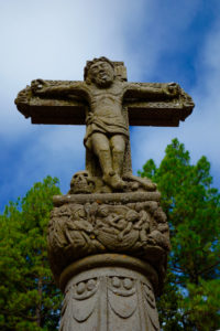
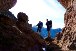
Photos Gran Canaria


Geef een reactie