Laugavegur trail – I met up a few times with my friend Ben to prepare a new hike. Choosing the right trail turned out to be the most difficult decision. After browsing through countless travel guides and surfing on numerous websites Iceland became the winner.
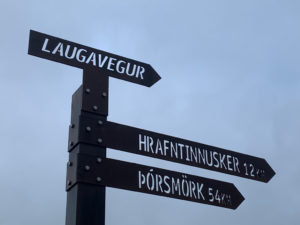
Because of the limited time, we finally opted for the popular Laugavegur and Fimmvorduhal trail. The trek between Landmannalaugar and Þórsmörk is the busiest hike in Iceland, whereby Icelanders often make the association with Reykjavik’s busiest shopping street, which is also called Laugavegur.
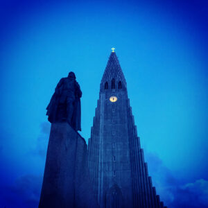
The advantage of busy paths is that they are usually popular for a reason, missing the beauty of this area would also be a shame. End August, the so-called bustle, was not that bad. We didn’t meet more than a few people a day. At the end of the summer vacation, we flew to Iceland, where we spent the night after a short bus ride in the City HI hostel in Reykjavik
Inhoud
Laugavegur trail & Fimmvörðuháls trail hike
↔ 88.36 km ↑ 3540 m ↓ 4289 m GPX
Day I Landmannalaugar – Hvanngil
↔ 27.07 km ↑ 1355 m ↓ 1444 m GPX
On Sunday we drove to Landmannalaugar with a reinforced bus, the plan was to start on the trail immediately but a warning on safetravel.is about storm weather kept us at the cabin for a day. We enjoyed the natural hot springs. At night the tent went wild in the announced storm.
In the morning the weather was not much better, the force of the wind had decreased but it was still raining cats and dogs. Next to our tent there were deserted tents that clearly had not survived the storm. We pack, eat something and leave on our way in the pouring rain.
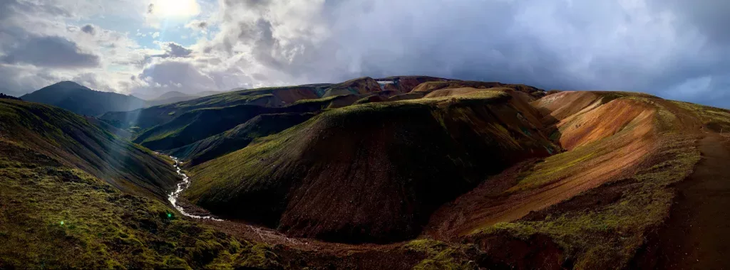
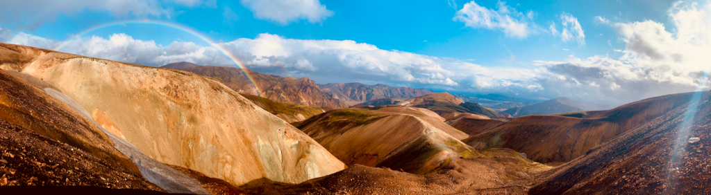
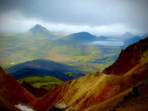
Through colorful rhyolite mountains
It doesn’t take long before we walk among beautiful rhyolite mountains that seem to constantly change colour. The playful game of the shining sun and the pouring rain make one colourful rainbow appear after the other. The sulphur fumes, smelling like rotten eggs come steaming from the earth.
We have just left and are already amazed. Steadily we’re climbing further up and cross our first snowfield. A small commemorative plaque for an Israeli named Ido who died on this route in 2004 during a storm once again illustrates how treacherous the weather can be here.
The ice-cold rain cuts in our weathered face when we arrive at the Hrafntinnusker hut. We can eat in the musty-smelling entrance hall of the hut. But at least we are sheltered. The hut warden asks if she should book a room in the next cabin. We reassure Katie that we are prepared for the bad weather and have a decent tent and a little later we’re back on the trail.
The first river crossing on the Laugavegur trail
First, we descend a bit and then a beautiful view opens up before us. A lush green wet valley shines under grey clouds. Again we are stunned. After a long steep descent, we have to wade through our first river. Next to a Spanish couple who are already fed up with the damp weather, we take off our shoes, put on surfing shoes and then thoughtfully cross the flowing river.
Some extra kilometres
We soon see the cabin where we want to put up our tent, or so we thought. When we arrive at the beautiful lake, we are not allowed to set up our bivouac because of the ongoing storm weather. We have to go to the next hut where we are more sheltered. Five extra and unforeseen kilometres, with another swirling river wading. So we continue.
When we arrive at Hvanngil, we quickly set up the soaked tent, which is wet and muddy from the fine black lava sand. Quickly prepare a warm meal and get into our warm sleeping bags. That’s it for today.
Day II Hvanngil – Þórsmörk
↔ 30.02 km ↑ 767 m ↓ 1168 m GPX
In the morning the weather cleared up a bit, we try to let everything dry out, but it doesn’t help much. We eat granola, put on our last pair dry walking socks and head back on the road. For a moment we have the company of two American firmly packed granny’s. They are constantly screaming ‘Amazing!’.
Barely on the trek or we have to wade again to cross a wide river. There is a strong current, so we cross the waterway in a concentrated way.
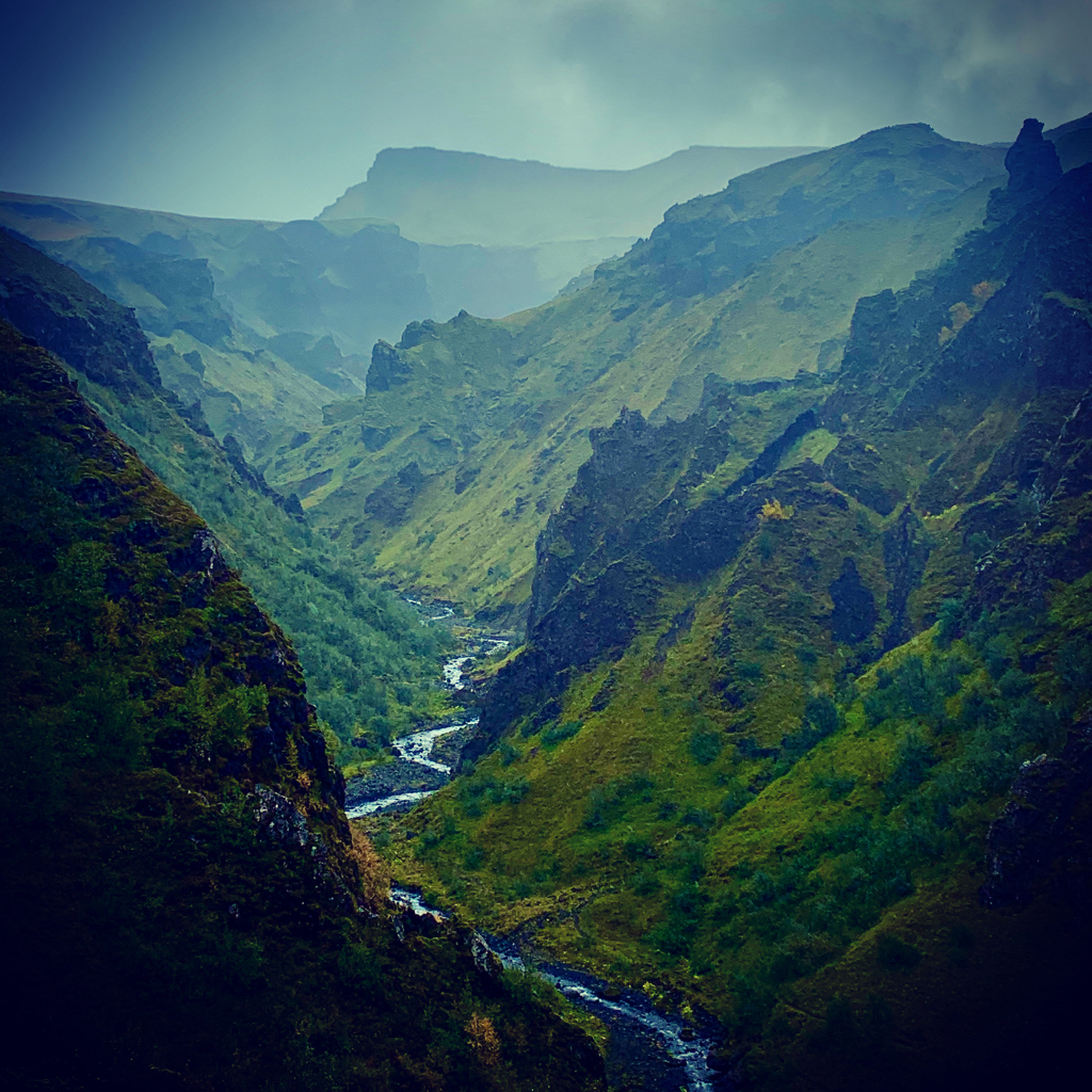
Along jet-black plateaus with lava sand to Emstrur
This is followed by a long walk with rain showers, again, on a plateau through black lava sand before we arrive at the Emstrur hut. There is a white tent where we can eat and relax. The weather clears up for a moment and we move on.
We pass beautifully deeply cut rivers, colourful mountains, jet-black plateaus and after a final river wading in strongly flowing water we saunter through the birch groves towards Þórsmörk.
Tired but satisfied, we set up the tent and prepare food in the tent provided for those who are not in the hut. Our first trail is finished, here we close the Laugavegur trail and tomorrow we will start the Fimmvörðuháls trail.
Fimmvörðuháls trail.
Day III Þórsmörk – Fimmvörðuháls
↔ 17.78 km ↑ 1267 m ↓ 596 m GPX

When we leave we are still sleepy and miss the bridge over the river in the wide riverbed, just a few extra kilometres, and we are on track again.
From the Bàsar hut immediately it goes up steeply. Another totally different landscape and both left and right of us there are beautifully cut out moist valleys with green and deep black hues.
Firm climb to the Eyjafjallajökull
We have to climb hard and the weather is getting worse with every altimeter. Thick fog sets up and the rain is back as usual. We have to navigate very concentratedly. After a few hours of hard climbing, we arrive at the pass between the Eyjafjallajökull and Mýrdalsjökull volcano. We walk along the Móði and Magni craters, named after the brave sons of Thor the thunder and storm god. Oh irony! A few years ago, the Eyjafjallajökull erupted here. The solidified magma and rock rubble are still silent witnesses of the recent eruptions.


We search for the emergency shelter where we will spend the night and walk over vast snowfields, glaciers and loose lava sand. For a moment there is confusion with another hut that we barely find in the fog, and we walk a few kilometres in the wrong direction. Eventually, we come across an impressive ice glacier before we reach our destination at the Baldvínskáli Hut. We are soaking wet and our shoes and socks are also soaked. We are happy that we can spend the night inside.
Day IV Fimmvörðuháls – Skógar
↔ 13.49 km ↑ 151 m ↓ 1081 m GPX
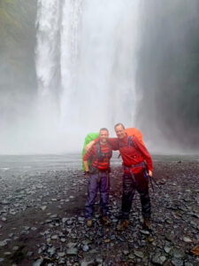
In the morning everything has dried up a bit, for the first time in days we can at least leave dry. We descend towards Skógar on a wide jeep track. The last 5 kilometres we marvel at the deeply cut gorges with one after the other bubbling waterfall that drops millions of litres water into the depth. Almost at our destination and suddenly … the sun.
‘There comes the sun’
It feels almost ecstatic to feel the warm sun rays on our faces. It is necessary too, everything is stiff due to the cold and wetness. My groin is open and my Achilles tendon is as hard as the granite from the area. Tired we arrive at the popular Skogafoss waterfall in Skógar.
Near the ring road, so it is suddenly very busy here with one-day tourists visiting the waterfalls. Tired we sit at a wooden pick-nick table in the bright sun, make a final meal and wait for the bus to Reykjavik.
Map
GPX
Practical info Laugavegur & Fimmvörðuháls
Money
In Iceland, you pay with Crowns. €10 is approximately 1400 Kr. Cash is hardly used and literally everywhere, from a shop in Reykjavik to the hut at the top of the Eyjafjallajökull you can pay with the card. I didn’t hold a coin or bill in eight days.
Life in Iceland is not cheap. A bus ride from the airport 24 €, H / T to the Landmannalaugar trail 100 €, place tent at the 2000 IK p.p., …
We stayed the first and last night in the City HI hostel, a cosy little hotel with many hikers. There is also a campsite with very good facilities. The Flybus and other organizations also make a stop here on their way to the hiking areas. The centre of Reykjavik is half an hour’s walk away or you can take bus 14 across the street.
Transport to Landmannalaugar
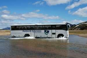
We flew directly from Brussels Airport to Reykjavik Keflavík airport. After every flight, there are bus companies that take you to the centre of the city (between € 20 and € 25 one way). Usually, these companies also provide the transfers to get elsewhere in Iceland unless you opt for private transportation or need a jeep to get to your starting point. We booked the ‘Flybus‘ in advance, which took us from Reykjavik to the start of the Landmannalaugar trail in the morning. It is a five-hour bus ride and you can opt for a flexible ‘Hiker’s pass‘ which you can then pick up in Þórsmörk or Skógar. You can visit each destination once with the hikers pass, so you do the journey in the direction that you want.
Signage
The route is marked with bollards (red and blue and yellow in the mountains) and some rivers have been bridged, such as the Kaldaklofskvísl, the Innri-Emstruá and the Fremri-Emstruá, all three wild glacier rivers originating from the Mýrdalsjökull.
Other rivers must be wade on foot. Water shoes or sandals and walking sticks are recommended when crossing the rivers.
Safety Laugavegur & Fimmvörðuháls trail

Before you set off, check safetravel.is the official source for safety warnings in Iceland. You will also see large boards with weather updates and conditions in bus stations. Do not ignore the advice and listen to the advice of the hut wardens on the trail. Before you leave, create a ‘Travel plan‘ on the website so that the emergency services know what you are going to do and where you are. The emergency number in Iceland is 112
Provisions & overnight stays on the Laugavegur trail & Fimmvörðuháls trail

There are mountain huts along the route, where you can spend the night and where camping is also allowed. Elsewhere on the route, camping is prohibited. Both the starting point and the endpoint can be reached by bus. The capacity of the cabins is limited; people who want to use have to book in advance.
All walkers are asked to sign a register on departure and arrival. We did the two trips combined on 4 days, it is recommended to do the Laugavegur on 4 days and the Fimmvörðuháls on two days. So in total six of days. The trip is something of a 55 + 27 km … with some extra kilometres we ended up with 88 kilometres.
There is a limited supply of food and drinks for sale in the cabins. All cabins have drinking water although it can sometimes be paying in hard to reach places such as the Baldvínskáli Hut.
Weather Laugavegur trail & Fimmvörðuháls trail
In good weather, the route is generally not a very difficult hike, but it must be borne in mind that those weather conditions will not always be optimal: dense fog (black fog), strong wind, snow and rain are not uncommon. Even in the summer, it is not uncommon for it to snow and hail. The water level of the rivers that need to be crossed can vary greatly. The summer hiking season runs from nearly mid-June to mid-September.
For accurate info visit the website of the Meteorological Institute of Iceland vedur.is. The institute also has a handy app to download from the Google Play Store or Apple App Store. Type VEDUR to find and install the app. You can change the language settings in the ‘settings’ (Stillingar). On the number +354 902 0600 you can always call for a daily updated weather forecast in English.
Also always view the warnings on safetravel.is.
Books & Maps
Links Laugavegur trail
- Follow us on Facebook, Instagram of Twitter
- Road conditions and weather
- What top pack for hiking the Laugavegur trail
English is not my native language. If you find any typos or mistakes > info@caersbart.be
Photos Laugavegur & Fimmvörðuháls


